Geolocate

Azurita topographic map

Click on the map to display elevation.

About this map
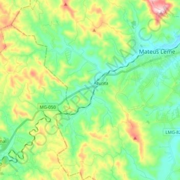
Name: Azurita topographic map, elevation, terrain.

Location: Azurita, Mateus Leme, Minas Gerais, Região Sudeste, Brasil (-20.08100 -44.54200 -19.94914 -44.44779)

Average elevation: 912 m

Minimum elevation: 757 m

Maximum elevation: 1,260 m

Other topographic maps

Click on a map to view its topography, its elevation and its terrain.

Serra do Mato Dentro

Brasil > Minas Gerais > Mateus Leme

Average elevation: 976 m

Barreado

Brasil > Minas Gerais > Mateus Leme

Average elevation: 952 m

Serra Azul

Brasil > Minas Gerais > Mateus Leme

Average elevation: 951 m

Gear up for your next adventure:

🥾Trekking Boots - Durable boots for long-distance trekking
💡LED Headlamp - Hands-free illumination for night hiking and camping
⛺Camping Essentials - All-in-one gear for a comfortable camping trip
🧥Thermal Layer - Insulating layer for cold outdoor conditions
🧭GPS Outdoor Watch - Smart watch for navigation and fitness tracking in nature

As an Amazon Associate, this site earns from qualifying purchases at no extra cost to you.