Dereham topographic map
Interactive map
Click on the map to display elevation.
About this map
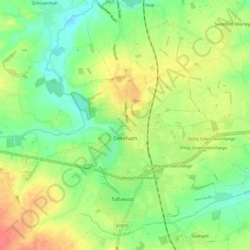
Name: Dereham topographic map, elevation, terrain.
Location: Dereham, Breckland District, Norfolk, England, United Kingdom (52.65621 0.90672 52.71057 1.00698)
Average elevation: 52 m
Minimum elevation: 27 m
Maximum elevation: 85 m
Other topographic maps
Click on a map to view its topography, its elevation and its terrain.
Swaffham
United Kingdom > England > Norfolk > Breckland District > Swaffham
Swaffham, Breckland District, Norfolk, England, United Kingdom
Average elevation: 61 m
Watton
United Kingdom > England > Norfolk > Breckland District > Watton
Watton, Breckland District, Norfolk, East of England, England, United Kingdom
Average elevation: 48 m