Geolocate

Kamba topographic map

Click on the map to display elevation.

About this map

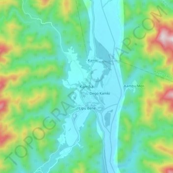
Name: Kamba topographic map, elevation, terrain.

Location: Kamba, Kamba ADC, Siang District, Arunachal Pradesh, India (28.22799 94.63636 28.30799 94.71636)

Average elevation: 465 m

Minimum elevation: 252 m

Maximum elevation: 1,122 m

Gear up for your next adventure:

🥾Waterproof Hiking Boots - Essential footwear for rugged terrain and wet Canadian trails
🔭Outdoor Binoculars - Lightweight binoculars for birdwatching and hiking
🧳Compression Sacks - Maximize space in your backpack by shrinking gear
🧭Orienteering Kit - Tools for map reading and navigation in the wild
🔦LED Flashlight - Powerful and long-lasting flashlight for camping and emergencies

As an Amazon Associate, this site earns from qualifying purchases at no extra cost to you.