
Make a donation
Gear up for your next adventure:
As an Amazon Associate, this site earns from qualifying purchases at no extra cost to you.
Bürgenstock topographic map
Click on the map to display elevation.
Make a donation
Gear up for your next adventure:
As an Amazon Associate, this site earns from qualifying purchases at no extra cost to you.
Bürgenstock
On the Dufourkarte (Dufour Map), the topographic map of Switzerland from 1844 to 1864, the mountain ridge as a whole had no name. The highest crest was referred to as Hametschwand.
Make a donation
Gear up for your next adventure:
As an Amazon Associate, this site earns from qualifying purchases at no extra cost to you.
About this map
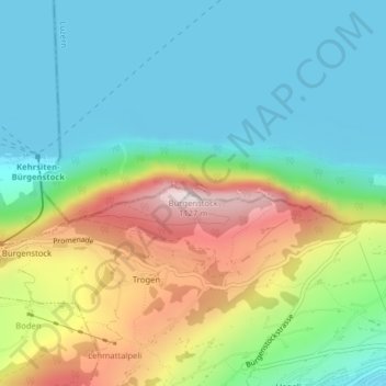
Name: Bürgenstock topographic map, elevation, terrain.
Location: Bürgenstock, Ennetbürgen, Nidwalden, 6373, Switzerland (47.00026 8.39828 47.00036 8.39838)
Average elevation: 641 m
Minimum elevation: 431 m
Maximum elevation: 1,096 m
Make a donation
Gear up for your next adventure:
As an Amazon Associate, this site earns from qualifying purchases at no extra cost to you.