Geolocate

Achacachi topographic map

Click on the map to display elevation.

Achacachi

Achacachi is at an elevation of 3,854 m or 12.647 feet amsl on the Achacachi peninsula on the eastern shores of Lake Titicaca, 96 km (60 mi) northwest of the capital La Paz.

Wikipedia (CC-BY-SA 3.0)

About this map

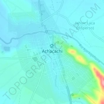
Name: Achacachi topographic map, elevation, terrain.

Location: Achacachi, Municipio Achacachi, Provincia Omasuyos, La Paz, Bolivia (-16.05881 -68.69801 -16.02956 -68.67282)

Average elevation: 3,839 m

Minimum elevation: 3,823 m

Maximum elevation: 3,942 m

Gear up for your next adventure:

🔋Lithium AA Batteries - Long-lasting power that performs in extreme cold
🥾Approach Boots - Comfortable boots for hiking and climbing approaches
🥾Trekking Boots - Durable boots for long-distance trekking
🍽️Titanium Camping Spork - Ultralight and indestructible eating utensil
🥾Trekking Poles - Adjustable trekking poles to reduce knee stress and improve stability

As an Amazon Associate, this site earns from qualifying purchases at no extra cost to you.