Geolocate

Ndaragwa topographic map

Click on the map to display elevation.

About this map

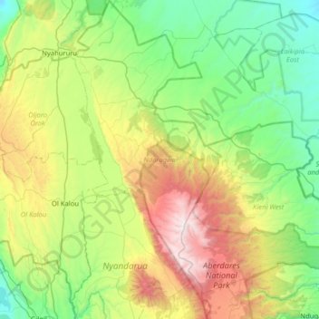
Name: Ndaragwa topographic map, elevation, terrain.

Location: Ndaragwa, Nyandarua, Central Kenya, Kenya (-0.49885 36.38970 0.13744 36.69092)

Average elevation: 2,380 m

Minimum elevation: 1,742 m

Maximum elevation: 3,975 m

Other topographic maps

Click on a map to view its topography, its elevation and its terrain.

Mount Satima

Kenya > Nyandarua

Average elevation: 3,805 m

Gear up for your next adventure:

🌬️Windproof Camp Stove - Efficient cooking even on exposed mountain peaks
🔭Compact Binoculars - Lightweight optics for scouting trails and wildlife
🔋Emergency Crank Radio - Weather alerts and power without needing batteries
💧Reusable Water Bottle - Durable water bottles for hydration on trails
🔦LED Headtorch - Bright and durable light for night activities

As an Amazon Associate, this site earns from qualifying purchases at no extra cost to you.