Geolocate

Pipa topographic map

Click on the map to display elevation.

About this map

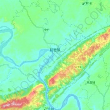
Name: Pipa topographic map, elevation, terrain.

Location: Pipa, Fushun County, Zigong, Sichuan, China (29.03585 105.00415 29.15389 105.12010)

Average elevation: 314 m

Minimum elevation: 243 m

Maximum elevation: 581 m

Gear up for your next adventure:

🔨Vehicle Emergency Tool - Safety tool for remote road trips to trailheads
🛁Quick-Dry Microfiber Towel - Space-saving towel that dries rapidly on the move
🔥Camping Stove - Portable stoves to cook outdoors with ease
❄️Traction Ice Cleats - Slip-on spikes for icy trails and winter hiking
🧳Compression Sacks - Maximize space in your backpack by shrinking gear

As an Amazon Associate, this site earns from qualifying purchases at no extra cost to you.