Geolocate

Duliajan topographic map

Click on the map to display elevation.

About this map

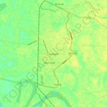
Name: Duliajan topographic map, elevation, terrain.

Location: Duliajan, Tengakhat, Dibrugarh District, Assam, 786602, India (27.31591 95.27923 27.39591 95.35923)

Average elevation: 121 m

Minimum elevation: 110 m

Maximum elevation: 127 m

Gear up for your next adventure:

Camping Essentials - All-in-one gear for a comfortable camping trip
🪑Insulated Seat Pad - Protect your seat from cold rocks and wet logs
🔋Solar Power Bank - Keep your GPS and devices charged during long outdoor trips
👟Leg Gaiters - Keep debris, mud, and snow out of your boots
🧣Evaporative Cooling Towel - Beat the heat during intense summer climbs

As an Amazon Associate, this site earns from qualifying purchases at no extra cost to you.