
Thank you for supporting this site ❤️
Make a donation
Make a donation
Gear up for your next adventure:
As an Amazon Associate, this site earns from qualifying purchases at no extra cost to you.
Lokapura topographic map
Click on the map to display elevation.
Thank you for supporting this site ❤️
Make a donation
Make a donation
Gear up for your next adventure:
As an Amazon Associate, this site earns from qualifying purchases at no extra cost to you.
About this map
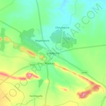
Name: Lokapura topographic map, elevation, terrain.
Location: Lokapura, Mudhola taluku, Bagalkote, Karnataka, 587122, India (16.12274 75.32859 16.20274 75.40859)
Average elevation: 570 m
Minimum elevation: 526 m
Maximum elevation: 657 m
Thank you for supporting this site ❤️
Make a donation
Make a donation
Gear up for your next adventure:
As an Amazon Associate, this site earns from qualifying purchases at no extra cost to you.