Geolocate

Haver topographic map

Click on the map to display elevation.

About this map

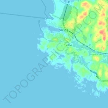
Name: Haver topographic map, elevation, terrain.

Location: Haver, Sirevåg, Hå, Rogaland, 4364, Norway (58.47472 5.77525 58.51472 5.81525)

Average elevation: 7 m

Minimum elevation: -5 m

Maximum elevation: 67 m

Gear up for your next adventure:

🔥Emergency Fire Starter - Reliable ignition source for all weather conditions
💡Compact LED Flashlight - Powerful and portable flashlight for outdoor use
🧦Hiking Socks - Moisture-wicking and comfortable socks for long hikes
🔦UV Flashlight - Detect minerals or specific insects in the dark
🔭Compact Binoculars - Lightweight optics for scouting trails and wildlife

As an Amazon Associate, this site earns from qualifying purchases at no extra cost to you.