
Sausa topographic map
Interactive map
Click on the map to display elevation.
About this map
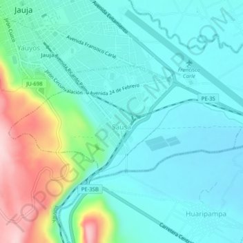
Name: Sausa topographic map, elevation, terrain.
Location: Sausa, Provincia de Jauja, Junín, Perú (-11.80166 -75.50241 -11.78407 -75.46340)
Average elevation: 3,397 m
Minimum elevation: 3,339 m
Maximum elevation: 3,592 m