Geolocate

Skeppmora topographic map

Click on the map to display elevation.

About this map

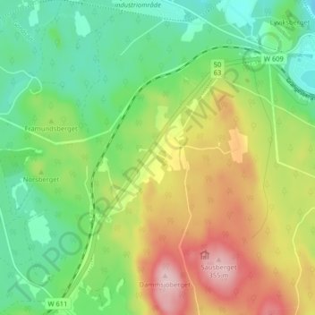
Name: Skeppmora topographic map, elevation, terrain.

Location: Skeppmora, Ludvika kommun, Dalarna County, 771 94, Sweden (60.10155 15.10436 60.14155 15.14436)

Average elevation: 227 m

Minimum elevation: 147 m

Maximum elevation: 353 m

Other topographic maps

Click on a map to view its topography, its elevation and its terrain.

Malung-Sälens kommun

Sweden > Dalarna County

Average elevation: 395 m

Gear up for your next adventure:

🥾Mountain Hiking Shoes - Shoes with superior grip for mountainous terrain
💧Reusable Water Bottle - Durable water bottles for hydration on trails
🥾Trail Running Shoes - Lightweight and durable shoes for trail running
💧Hydration Bladder - Hands-free hydration solution for long treks
🧤Thermal Hiking Gloves - Grip-enhanced gloves for cold-weather altitude trekking

As an Amazon Associate, this site earns from qualifying purchases at no extra cost to you.