
Thank you for supporting this site ❤️
Make a donation
Make a donation
Gear up for your next adventure:
As an Amazon Associate, this site earns from qualifying purchases at no extra cost to you.
Jorge topographic map
Click on the map to display elevation.
Thank you for supporting this site ❤️
Make a donation
Make a donation
Gear up for your next adventure:
As an Amazon Associate, this site earns from qualifying purchases at no extra cost to you.
About this map
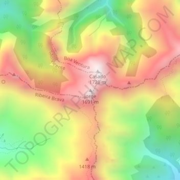
Name: Jorge topographic map, elevation, terrain.
Location: Jorge, São Vicente, Madeira, 9030-319, Portugal (32.75392 -16.98529 32.75402 -16.98519)
Average elevation: 1,198 m
Minimum elevation: 661 m
Maximum elevation: 1,694 m
Thank you for supporting this site ❤️
Make a donation
Make a donation
Gear up for your next adventure:
As an Amazon Associate, this site earns from qualifying purchases at no extra cost to you.