Geolocate

Caborana topographic map

Click on the map to display elevation.

About this map

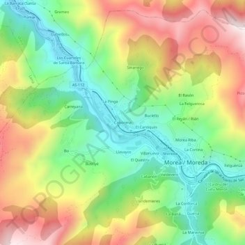
Name: Caborana topographic map, elevation, terrain.

Location: Caborana, Moreda, Aller, 33684, España (43.15491 -5.77259 43.19491 -5.73259)

Average elevation: 549 m

Minimum elevation: 253 m

Maximum elevation: 941 m

Gear up for your next adventure:

🥾Trail Hiking Socks - Comfortable socks to prevent blisters and fatigue
Backpacking Tent - Lightweight tent for long-distance hiking trips
🥾Light Trekking Boots - Supportive boots for multi-day treks
🎒Hiking Backpack - Lightweight and ergonomic backpacks for day hikes or multi-day treks
🛶Canoe Life Vest - Safety vest for water sports

As an Amazon Associate, this site earns from qualifying purchases at no extra cost to you.