Geolocate

Sardis topographic map

Click on the map to display elevation.

About this map

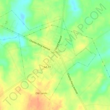
Name: Sardis topographic map, elevation, terrain.

Location: Sardis, Burke County, Georgia, United States (32.96121 -81.78144 32.98723 -81.74349)

Average elevation: 69 m

Minimum elevation: 48 m

Maximum elevation: 88 m

Other topographic maps

Click on a map to view its topography, its elevation and its terrain.

Watkins Pond

United States > Georgia > Burke County

Average elevation: 78 m

Gear up for your next adventure:

🦶Hiking Shoe Insoles - Added support for high arches and long days on feet
🧭GPS Tracker - Track your location in remote areas safely
Camping Tent - Weather-resistant tents suitable for 2 to 6 people
🧼Biodegradable Camp Soap - Environmentally friendly cleaning for gear and body
🧊Portable Cooler - Keep food and drinks cold during outdoor adventures

As an Amazon Associate, this site earns from qualifying purchases at no extra cost to you.