
Thank you for supporting this site ❤️
Make a donation
Make a donation
Gear up for your next adventure:
As an Amazon Associate, this site earns from qualifying purchases at no extra cost to you.
Tuluá topographic map
Click on the map to display elevation.
Thank you for supporting this site ❤️
Make a donation
Make a donation
Gear up for your next adventure:
As an Amazon Associate, this site earns from qualifying purchases at no extra cost to you.
About this map
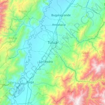
Name: Tuluá topographic map, elevation, terrain.
Location: Tuluá, Centro, Valle del Cauca, RAP Pacífico, Colombia (3.88889 -76.31391 4.18556 -75.82016)
Average elevation: 1,555 m
Minimum elevation: 914 m
Maximum elevation: 3,892 m
Thank you for supporting this site ❤️
Make a donation
Make a donation
Gear up for your next adventure:
As an Amazon Associate, this site earns from qualifying purchases at no extra cost to you.