
Thank you for supporting this site ❤️
Make a donation
Make a donation
Gear up for your next adventure:
As an Amazon Associate, this site earns from qualifying purchases at no extra cost to you.
Pomasqui topographic map
Click on the map to display elevation.
Thank you for supporting this site ❤️
Make a donation
Make a donation
Gear up for your next adventure:
As an Amazon Associate, this site earns from qualifying purchases at no extra cost to you.
About this map
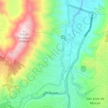
Name: Pomasqui topographic map, elevation, terrain.
Location: Pomasqui, Quito Canton, Pichincha, 170380, Ecuador (-0.07488 -78.49221 -0.02071 -78.42782)
Average elevation: 2,729 m
Minimum elevation: 2,351 m
Maximum elevation: 3,506 m
Thank you for supporting this site ❤️
Make a donation
Make a donation
Gear up for your next adventure:
As an Amazon Associate, this site earns from qualifying purchases at no extra cost to you.