
St. Paul topographic map
Interactive map
Click on the map to display elevation.
About this map
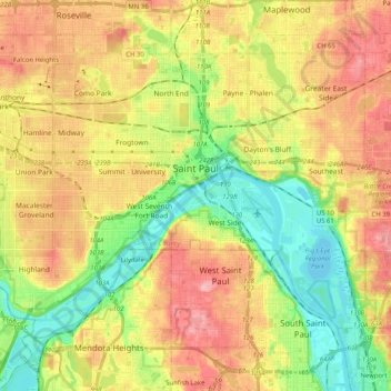
Name: St. Paul topographic map, elevation, terrain.
Average elevation: 266 m
Minimum elevation: 207 m
Maximum elevation: 334 m
Other topographic maps
Click on a map to view its topography, its elevation and its terrain.
Cathedral Hill Park
Estados Unidos de América > Minnesota > St. Paul
Cathedral Hill Park, St. Paul, Ramsey County, Minnesota, Estados Unidos de América
Average elevation: 252 m