Geolocate

Stixe topographic map

Click on the map to display elevation.

About this map

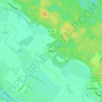
Name: Stixe topographic map, elevation, terrain.

Location: Stixe, Amt Neuhaus, Lüneburg, Lower Saxony, Germany (53.18837 10.99626 53.22837 11.03626)

Average elevation: 14 m

Minimum elevation: 5 m

Maximum elevation: 31 m

Gear up for your next adventure:

🏕️Camping Hammock - Integrated protection for sleeping between trees
🧢Outdoor Cap - Protective cap for sun and rain during hikes
🧰Survival Kit - Essential gear for emergencies in the wilderness
🧦Thermal Socks - Warm socks for winter hiking or camping
🛁Quick-Dry Microfiber Towel - Space-saving towel that dries rapidly on the move

As an Amazon Associate, this site earns from qualifying purchases at no extra cost to you.