
Thank you for supporting this site ❤️
Make a donation
Make a donation
Gear up for your next adventure:
As an Amazon Associate, this site earns from qualifying purchases at no extra cost to you.
Fontaínhas topographic map
Click on the map to display elevation.
Thank you for supporting this site ❤️
Make a donation
Make a donation
Gear up for your next adventure:
As an Amazon Associate, this site earns from qualifying purchases at no extra cost to you.
About this map
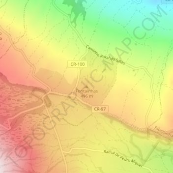
Name: Fontaínhas topographic map, elevation, terrain.
Location: Fontaínhas, Salão, Horta, Açores, 9900-501, Portugal (38.60035 -28.67239 38.60045 -28.67229)
Average elevation: 439 m
Minimum elevation: 139 m
Maximum elevation: 690 m
Thank you for supporting this site ❤️
Make a donation
Make a donation
Gear up for your next adventure:
As an Amazon Associate, this site earns from qualifying purchases at no extra cost to you.