
Thank you for supporting this site ❤️
Make a donation
Make a donation
Gear up for your next adventure:
As an Amazon Associate, this site earns from qualifying purchases at no extra cost to you.
Pachuquilla topographic map
Click on the map to display elevation.
Thank you for supporting this site ❤️
Make a donation
Make a donation
Gear up for your next adventure:
As an Amazon Associate, this site earns from qualifying purchases at no extra cost to you.
About this map
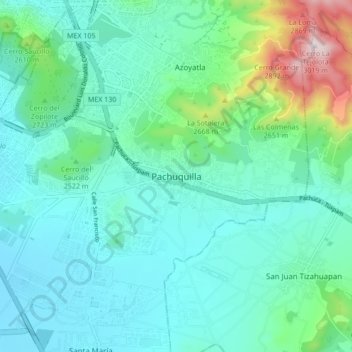
Name: Pachuquilla topographic map, elevation, terrain.
Location: Pachuquilla, Mineral de la Reforma, Hidalgo, 42180, Mexico (20.03224 -98.73620 20.11224 -98.65620)
Average elevation: 2,474 m
Minimum elevation: 2,343 m
Maximum elevation: 3,027 m
Thank you for supporting this site ❤️
Make a donation
Make a donation
Gear up for your next adventure:
As an Amazon Associate, this site earns from qualifying purchases at no extra cost to you.