Geolocate

Stearnes topographic map

Click on the map to display elevation.

About this map

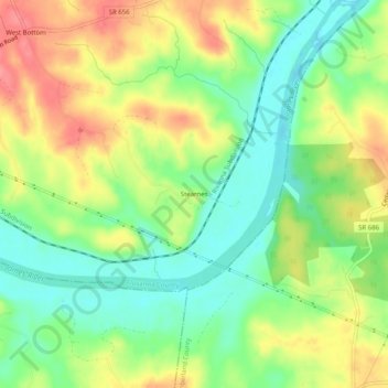
Name: Stearnes topographic map, elevation, terrain.

Location: Stearnes, Fluvanna County, Virginia, United States (37.68042 -78.25889 37.72042 -78.21889)

Average elevation: 91 m

Minimum elevation: 55 m

Maximum elevation: 134 m

Other topographic maps

Click on a map to view its topography, its elevation and its terrain.

Columbia

United States > Virginia > Fluvanna County

Average elevation: 78 m

Gear up for your next adventure:

🧼Travel Hand Sanitizer - Keep hands clean when water is scarce
🥾Trail Running Shoes - Lightweight and durable shoes for trail running
🥾Lightweight Hiking Boots - Boots for comfort and mobility on long hikes
🦶Anti-Blister Balm - Prevents friction and hotspots during long ascents
🧊Insulated Water Bottle - Keeps drinks cold in summer and prevents freezing in winter

As an Amazon Associate, this site earns from qualifying purchases at no extra cost to you.