
Thank you for supporting this site ❤️
Make a donation
Make a donation
Gear up for your next adventure:
As an Amazon Associate, this site earns from qualifying purchases at no extra cost to you.
Mukhiguda topographic map
Click on the map to display elevation.
Thank you for supporting this site ❤️
Make a donation
Make a donation
Gear up for your next adventure:
As an Amazon Associate, this site earns from qualifying purchases at no extra cost to you.
About this map
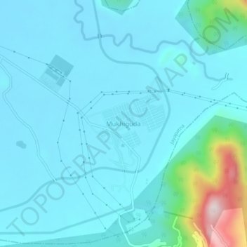
Name: Mukhiguda topographic map, elevation, terrain.
Location: Mukhiguda, Jayapatna, Kalahandi District, Odisha, India (19.42105 82.83315 19.46105 82.87315)
Average elevation: 308 m
Minimum elevation: 243 m
Maximum elevation: 777 m
Thank you for supporting this site ❤️
Make a donation
Make a donation
Gear up for your next adventure:
As an Amazon Associate, this site earns from qualifying purchases at no extra cost to you.