
Thank you for supporting this site ❤️
Make a donation
Make a donation
Gear up for your next adventure:
As an Amazon Associate, this site earns from qualifying purchases at no extra cost to you.
Monteforte topographic map
Click on the map to display elevation.
Thank you for supporting this site ❤️
Make a donation
Make a donation
Gear up for your next adventure:
As an Amazon Associate, this site earns from qualifying purchases at no extra cost to you.
About this map
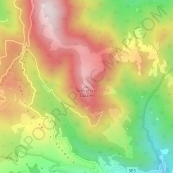
Name: Monteforte topographic map, elevation, terrain.
Location: Monteforte, Abriola, Potenza, Basilicata, 85010, Italia (40.52457 15.80266 40.52467 15.80276)
Average elevation: 1,171 m
Minimum elevation: 836 m
Maximum elevation: 1,475 m
Thank you for supporting this site ❤️
Make a donation
Make a donation
Gear up for your next adventure:
As an Amazon Associate, this site earns from qualifying purchases at no extra cost to you.