
Barrera S. topographic map
Interactive map
Click on the map to display elevation.
About this map
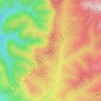
Name: Barrera S. topographic map, elevation, terrain.
Location: Barrera S., Navascués/Nabaskoze, Pirinioak / Pirineo, Spanje (42.72904 -1.07053 42.72914 -1.07043)
Average elevation: 873 m
Minimum elevation: 681 m
Maximum elevation: 1,023 m