
Anhui topographic map
Interactive map
Click on the map to display elevation.
About this map
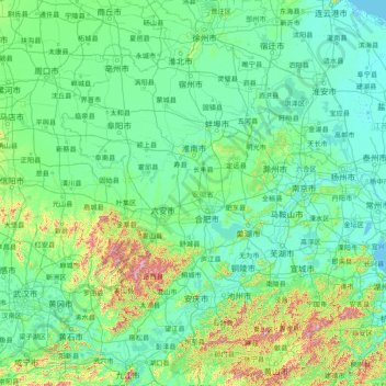
Name: Anhui topographic map, elevation, terrain.
Location: Anhui, China (29.39523 114.87665 34.65374 119.64532)
Average elevation: 99 m
Minimum elevation: -3 m
Maximum elevation: 1,658 m
Other topographic maps
Click on a map to view its topography, its elevation and its terrain.