
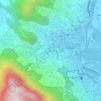
Rivière Saint-Louis topographic map
Interactive map
Click on the map to display elevation.
About this map
Name: Rivière Saint-Louis topographic map, elevation, terrain.
Location: Rivière Saint-Louis, Victoria, Bel Air, Seychelles (-4.62487 55.44428 -4.62293 55.44966)
Average elevation: 170 m
Minimum elevation: -5 m
Maximum elevation: 740 m