Kapseret topographic map
Interactive map
Click on the map to display elevation.
About this map
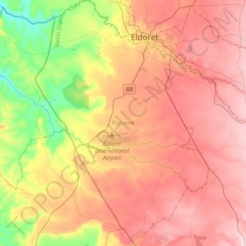
Name: Kapseret topographic map, elevation, terrain.
Location: Kapseret, Uasin Gishu County, Rift Valley, Kenya (0.27463 35.14313 0.56286 35.34698)
Average elevation: 2,092 m
Minimum elevation: 1,852 m
Maximum elevation: 2,290 m
Other topographic maps
Click on a map to view its topography, its elevation and its terrain.
Kesses
Kesses, Uasin Gishu County, Rift Valley, Kenya
Average elevation: 2,224 m
Ainabkoi
Ainabkoi, Uasin Gishu County, Rift Valley, Kenya
Average elevation: 2,168 m
Moiben
Moiben, Uasin Gishu County, Rift Valley, 30100, Kenya
Average elevation: 2,000 m
Turbo
Turbo, Uasin Gishu County, Rift Valley, Kenya
Average elevation: 1,908 m
Eldoret
Eldoret, Uasin Gishu County, 30100, Kenya
Average elevation: 2,093 m