
Make a donation
Gear up for your next adventure:
As an Amazon Associate, this site earns from qualifying purchases at no extra cost to you.
Salur topographic map
Click on the map to display elevation.
Make a donation
Gear up for your next adventure:
As an Amazon Associate, this site earns from qualifying purchases at no extra cost to you.
Salur
Salur is on the banks of River Vegavathi at 18°32′00″N 83°13′00″E / 18.5333°N 83.2167°E / 18.5333; 83.2167. It has an average elevation of 118 metres (387 ft). It is bounded by Makkuva, Bobbili, Ramabhadrapuram and Pachipenta mandals of Andhra Pradesh state. Salur is surrounded with green forests and chains of hills on two sides and by River Vegavathi on the other two.
Make a donation
Gear up for your next adventure:
As an Amazon Associate, this site earns from qualifying purchases at no extra cost to you.
About this map
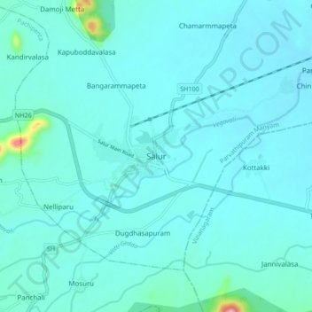
Name: Salur topographic map, elevation, terrain.
Location: Salur, Parvathipuram Manyam, Andhra Pradesh, 532591, India (18.47770 83.16810 18.55770 83.24810)
Average elevation: 163 m
Minimum elevation: 132 m
Maximum elevation: 480 m
Make a donation
Gear up for your next adventure:
As an Amazon Associate, this site earns from qualifying purchases at no extra cost to you.