
Thank you for supporting this site ❤️
Make a donation
Make a donation
Gear up for your next adventure:
As an Amazon Associate, this site earns from qualifying purchases at no extra cost to you.
Caranca topographic map
Click on the map to display elevation.
Thank you for supporting this site ❤️
Make a donation
Make a donation
Gear up for your next adventure:
As an Amazon Associate, this site earns from qualifying purchases at no extra cost to you.
About this map
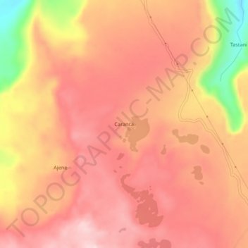
Name: Caranca topographic map, elevation, terrain.
Location: Caranca, Sañayca, Aymaraes, Apurímac, Perú (-14.44146 -73.39021 -14.40146 -73.35021)
Average elevation: 4,332 m
Minimum elevation: 4,130 m
Maximum elevation: 4,420 m
Thank you for supporting this site ❤️
Make a donation
Make a donation
Gear up for your next adventure:
As an Amazon Associate, this site earns from qualifying purchases at no extra cost to you.