
Table Rock topographic map
Click on the map to display elevation.
About this map
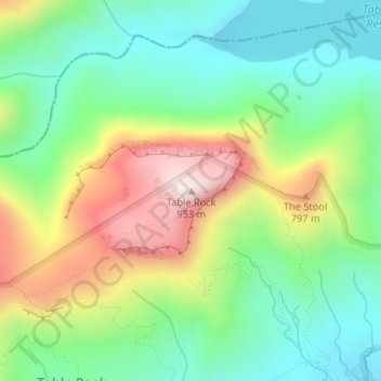
Name: Table Rock topographic map, elevation, terrain.
Location: Table Rock, Pickens County, South Carolina, United States (35.05062 -82.70351 35.05072 -82.70341)
Average elevation: 579 m
Minimum elevation: 368 m
Maximum elevation: 948 m