Geolocate

Chabua topographic map

Click on the map to display elevation.

About this map

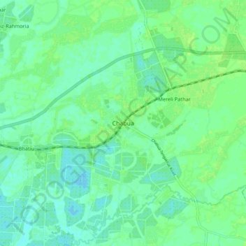
Name: Chabua topographic map, elevation, terrain.

Location: Chabua, Dibrugarh District, Assam, 786184, India (27.44268 95.13303 27.52268 95.21303)

Average elevation: 115 m

Minimum elevation: 109 m

Maximum elevation: 120 m

Gear up for your next adventure:

🥾All-Terrain Hiking Boots - Versatile boots for varied hiking conditions
🚲Heavy Duty Bike Lock - Secure your bike at the trailhead or during stops
🔋Solar Power Bank - Keep your GPS and devices charged during long outdoor trips
🎒Hiking Daypack - Lightweight and durable backpacks for day trips and excursions
🧭GPS Outdoor Watch - Smart watch for navigation and fitness tracking in nature

As an Amazon Associate, this site earns from qualifying purchases at no extra cost to you.