
La Laguna topographic map
Interactive map
Click on the map to display elevation.
About this map
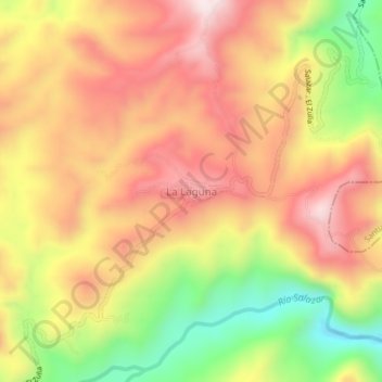
Name: La Laguna topographic map, elevation, terrain.
Average elevation: 874 m
Minimum elevation: 555 m
Maximum elevation: 1,116 m
Other topographic maps
Click on a map to view its topography, its elevation and its terrain.
Zulia
Colombia > Norte de Santander > Salazar
Zulia, Salazar, Centro, Norte de Santander, RAP Gran Santander, Colombia
Average elevation: 1,000 m