
Thank you for supporting this site ❤️
Make a donation
Make a donation
Gear up for your next adventure:
As an Amazon Associate, this site earns from qualifying purchases at no extra cost to you.
Wagholi topographic map
Click on the map to display elevation.
Thank you for supporting this site ❤️
Make a donation
Make a donation
Gear up for your next adventure:
As an Amazon Associate, this site earns from qualifying purchases at no extra cost to you.
About this map
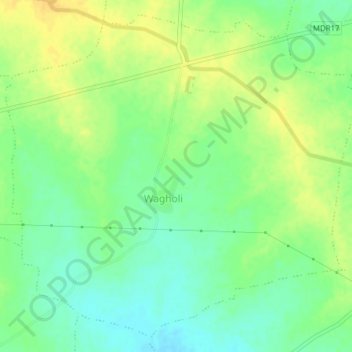
Name: Wagholi topographic map, elevation, terrain.
Location: Wagholi, Dhamangaon Railway, Amravati, Maharashtra, India (20.78829 78.16138 20.82131 78.19987)
Average elevation: 296 m
Minimum elevation: 283 m
Maximum elevation: 308 m
Thank you for supporting this site ❤️
Make a donation
Make a donation
Gear up for your next adventure:
As an Amazon Associate, this site earns from qualifying purchases at no extra cost to you.