
Thank you for supporting this site ❤️
Make a donation
Make a donation
Gear up for your next adventure:
As an Amazon Associate, this site earns from qualifying purchases at no extra cost to you.
Quinto topographic map
Click on the map to display elevation.
Thank you for supporting this site ❤️
Make a donation
Make a donation
Gear up for your next adventure:
As an Amazon Associate, this site earns from qualifying purchases at no extra cost to you.
About this map
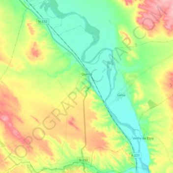
Name: Quinto topographic map, elevation, terrain.
Location: Quinto, Ribera Baja del Ebro, Zaragoza, Aragón, 50770, Spanje (41.34550 -0.60386 41.48388 -0.44751)
Average elevation: 204 m
Minimum elevation: 142 m
Maximum elevation: 301 m
Thank you for supporting this site ❤️
Make a donation
Make a donation
Gear up for your next adventure:
As an Amazon Associate, this site earns from qualifying purchases at no extra cost to you.