Geolocate

Wallberg topographic map

Click on the map to display elevation.

About this map

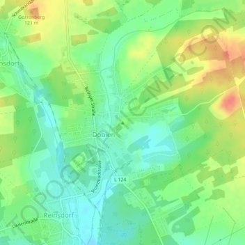
Name: Wallberg topographic map, elevation, terrain.

Location: Wallberg, Wittenberg, Saxony-Anhalt, 06886, Germany (51.90409 12.61613 51.90419 12.61623)

Average elevation: 98 m

Minimum elevation: 79 m

Maximum elevation: 124 m

Gear up for your next adventure:

🧭GPS Tracker - Track your location in remote areas safely
🧦Merino Wool Socks - Moisture-wicking comfort for long-distance hiking
Camping Groundsheet - Protect your tent from moisture and dirt
🌡️Emergency Mylar Blankets - Compact thermal protection for unexpected nights outdoors
🎒Fully Waterproof Backpack - Total protection for photography gear and electronics

As an Amazon Associate, this site earns from qualifying purchases at no extra cost to you.