
Thank you for supporting this site ❤️
Make a donation
Make a donation
Gear up for your next adventure:
As an Amazon Associate, this site earns from qualifying purchases at no extra cost to you.
Buri topographic map
Click on the map to display elevation.
Thank you for supporting this site ❤️
Make a donation
Make a donation
Gear up for your next adventure:
As an Amazon Associate, this site earns from qualifying purchases at no extra cost to you.
About this map
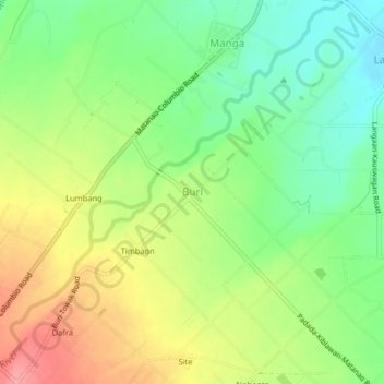
Name: Buri topographic map, elevation, terrain.
Location: Buri, Matanao, Davao del Sur, Davao Region, 8003, Philippines (6.64472 125.17509 6.68472 125.21509)
Average elevation: 85 m
Minimum elevation: 43 m
Maximum elevation: 138 m
Thank you for supporting this site ❤️
Make a donation
Make a donation
Gear up for your next adventure:
As an Amazon Associate, this site earns from qualifying purchases at no extra cost to you.