
Make a donation
Gear up for your next adventure:
As an Amazon Associate, this site earns from qualifying purchases at no extra cost to you.
Florida City topographic map
Click on the map to display elevation.
Make a donation
Gear up for your next adventure:
As an Amazon Associate, this site earns from qualifying purchases at no extra cost to you.
Florida City
Florida City is situated mostly atop a limestone ridge called the Miami Rock Ridge[6] that extends south from present day North Miami Beach[7] to a location in Everglades National Park.[8] The ridge, consisting of Miami limestone,[9] serves as the higher ground within the community. The ridge extended from northeast to southwest across the city. The old location of the Florida East Coast Railway track marks the approximate boundary of the location of the limestone ridge south of Davis Parkway. The range of elevation of the ridge is from 5 to 8 feet (1.5–2.4 meters) above sea level.
Make a donation
Gear up for your next adventure:
As an Amazon Associate, this site earns from qualifying purchases at no extra cost to you.
About this map
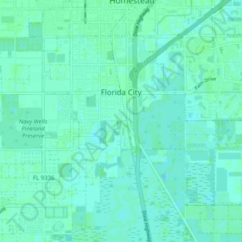
Name: Florida City topographic map, elevation, terrain.
Average elevation: 3 m
Minimum elevation: 0 m
Maximum elevation: 8 m
Make a donation
Gear up for your next adventure:
As an Amazon Associate, this site earns from qualifying purchases at no extra cost to you.
Other topographic maps
Click on a map to view its topography, its elevation and its terrain.
Miami
United States > Florida > Miami-Dade County
Miami and its suburbs are located on a broad plain between the Everglades to the west and Biscayne Bay to the east, which extends from Lake Okeechobee southward to Florida Bay. The elevation of the area averages at around 6 ft (1.8 m) above sea level in most neighborhoods, especially near the coast. The…
Average elevation: 4 m
Make a donation
Gear up for your next adventure:
As an Amazon Associate, this site earns from qualifying purchases at no extra cost to you.
Make a donation
Gear up for your next adventure:
As an Amazon Associate, this site earns from qualifying purchases at no extra cost to you.
Leisure Mobile Home Park-Modello Park
United States > Florida > Miami-Dade County > Leisure Mobile Home Park-Modello Park
Average elevation: 5 m
Brickell Hammock
United States > Florida > Miami-Dade County > Miami > Brickell Hammock
Average elevation: 6 m