Geolocate

Alforja topographic map

Click on the map to display elevation.

About this map

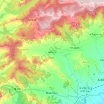
Name: Alforja topographic map, elevation, terrain.

Location: Alforja, Baix Camp, Tarragona, Catalonia, 43365, Spain (41.17833 0.87711 41.24096 1.01739)

Average elevation: 525 m

Minimum elevation: 159 m

Maximum elevation: 1,036 m

Gear up for your next adventure:

🦟Insect Repellent - Keep mosquitoes and black flies away in wooded areas
Lightweight Camping Tent - Portable shelter optimized for Canadian backcountry camping
🩹Compact First Aid Kit - Pre-packed essentials for common trail injuries
🧢Outdoor Visor - Breathable visor for sunny hikes
🔋Emergency Crank Radio - Weather alerts and power without needing batteries

As an Amazon Associate, this site earns from qualifying purchases at no extra cost to you.