Geolocate

Chaplin topographic map

Click on the map to display elevation.

About this map

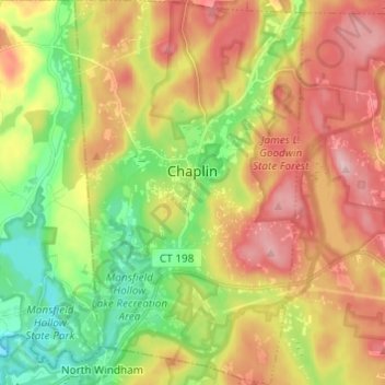
Name: Chaplin topographic map, elevation, terrain.

Location: Chaplin, Windham County, Connecticut, 06235, United States (41.74450 -72.16457 41.83502 -72.09220)

Average elevation: 147 m

Minimum elevation: 54 m

Maximum elevation: 248 m

Gear up for your next adventure:

🧦Thermal Socks - Warm socks for winter hiking or camping
🦶Anti-Blister Balm - Prevents friction and hotspots during long ascents
🧥Waterproof Hiking Jacket - Protect yourself from rain and wind while hiking
🥾Waterproof Hiking Boots - Boots keeping your feet dry in wet conditions
🧶550 Survival Paracord - Versatile utility cord for emergency repairs and rigging

As an Amazon Associate, this site earns from qualifying purchases at no extra cost to you.