Geolocate

Freuchie topographic map

Click on the map to display elevation.

About this map

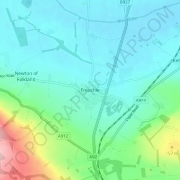
Name: Freuchie topographic map, elevation, terrain.

Location: Freuchie, Fife, Scotland, KY15 7EJ, United Kingdom (56.22860 -3.17697 56.26860 -3.13697)

Average elevation: 78 m

Minimum elevation: 34 m

Maximum elevation: 248 m

Gear up for your next adventure:

🧰Survival Kit - Essential gear for emergencies in the wilderness
Camping Essentials - All-in-one gear for a comfortable camping trip
🧴Waterproofing Spray - Restore the DWR coating on jackets and tents
🦶Anti-Blister Balm - Prevents friction and hotspots during long ascents
Camping Groundsheet - Protect your tent from moisture and dirt

As an Amazon Associate, this site earns from qualifying purchases at no extra cost to you.