Geolocate

Aya topographic map

Click on the map to display elevation.

About this map

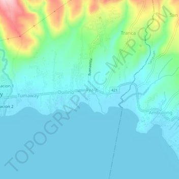
Name: Aya topographic map, elevation, terrain.

Location: Aya, Talisay, Batangas, Calabarzon, 2020, Philippines (14.07492 121.02378 14.11492 121.06378)

Average elevation: 46 m

Minimum elevation: 3 m

Maximum elevation: 223 m

Gear up for your next adventure:

🚑Survival Whistle - Signal for help across long distances in mountains
🧢Sun Hat - Wide-brim hat for sun protection
🧣Evaporative Cooling Towel - Beat the heat during intense summer climbs
🪜Heavy Duty Carabiners - Multi-use clips for securing gear to your backpack
🪑Insulated Seat Pad - Protect your seat from cold rocks and wet logs

As an Amazon Associate, this site earns from qualifying purchases at no extra cost to you.