Geolocate

Atazar topographic map

Click on the map to display elevation.

About this map

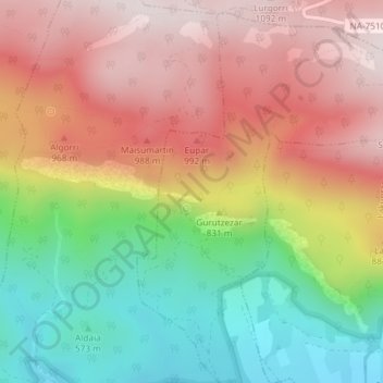
Name: Atazar topographic map, elevation, terrain.

Location: Atazar, Arruazu, Sakana, Navarra, 31839, España (42.93411 -2.02263 42.95411 -2.00263)

Average elevation: 796 m

Minimum elevation: 475 m

Maximum elevation: 1,092 m

Gear up for your next adventure:

🦶Anti-Blister Balm - Prevents friction and hotspots during long ascents
🧶550 Survival Paracord - Versatile utility cord for emergency repairs and rigging
🚲MTB Frame Bag - Carry tools and maps directly on your bicycle frame
🏕️Camping Hammock - Integrated protection for sleeping between trees
🧢Hiking Sun Hat - Wide-brimmed protection for exposed mountain ridges

As an Amazon Associate, this site earns from qualifying purchases at no extra cost to you.