
Make a donation
Gear up for your next adventure:
As an Amazon Associate, this site earns from qualifying purchases at no extra cost to you.
Berchem topographic map
Click on the map to display elevation.
Make a donation
Gear up for your next adventure:
As an Amazon Associate, this site earns from qualifying purchases at no extra cost to you.
About this map
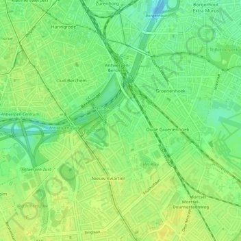
Name: Berchem topographic map, elevation, terrain.
Location: Berchem, Anvers, Flandre, 2600, Belgique (51.17670 4.41046 51.20724 4.45162)
Average elevation: 12 m
Minimum elevation: -4 m
Maximum elevation: 20 m
Make a donation
Gear up for your next adventure:
As an Amazon Associate, this site earns from qualifying purchases at no extra cost to you.
Other topographic maps
Click on a map to view its topography, its elevation and its terrain.
Anvers
Belgique > Anvers > Anvers > Anvers
Sa véritable expansion ne remonterait selon l'historiographie classique qu’aux alentours de l’an 900, lorsque les habitants agrandissent le légendaire Aanwerp, terrain surélevé de la primitive jetée qui donne son nom à Anvers. En 970, une fois l'ordre ottonien imposé, Anvers n'est encore qu'un poste…
Average elevation: 9 m