Geolocate

Pian Rosa topographic map

Click on the map to display elevation.

About this map

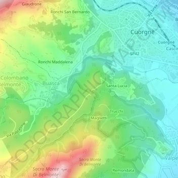
Name: Pian Rosa topographic map, elevation, terrain.

Location: Pian Rosa, Santa Lucia, Cuorgnè, Torino, Piedmont, 10080, Italy (45.37104 7.62830 45.39104 7.64830)

Average elevation: 487 m

Minimum elevation: 375 m

Maximum elevation: 719 m

Gear up for your next adventure:

💡Compact LED Flashlight - Powerful and portable flashlight for outdoor use
🧢Sun Hat - Wide-brim hat for sun protection
🔋Lithium AA Batteries - Long-lasting power that performs in extreme cold
🎒Hiking Daypack - Lightweight and durable backpacks for day trips and excursions
🔦LED Headtorch - Bright and durable light for night activities

As an Amazon Associate, this site earns from qualifying purchases at no extra cost to you.