Geolocate

Cons topographic map

Click on the map to display elevation.

About this map

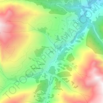
Name: Cons topographic map, elevation, terrain.

Location: Cons, Vrin, Lumnezia, Surselva, Grisons, 7149, Switzerland (46.62907 9.07050 46.66907 9.11050)

Average elevation: 1,783 m

Minimum elevation: 1,183 m

Maximum elevation: 2,568 m

Gear up for your next adventure:

🧭GPS Outdoor Watch - Smart watch for navigation and fitness tracking in nature
🔦LED Flashlight - Powerful and long-lasting flashlight for camping and emergencies
🥾Waterproof Hiking Boots - Essential footwear for rugged terrain and wet Canadian trails
🥾Hiking Shoes - Durable and comfortable shoes for trail hiking
🥾Hiking Boots - Sturdy boots providing ankle support and traction on rugged trails

As an Amazon Associate, this site earns from qualifying purchases at no extra cost to you.