Geolocate

Ittel topographic map

Click on the map to display elevation.

About this map

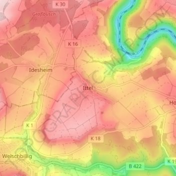
Name: Ittel topographic map, elevation, terrain.

Location: Ittel, Welschbillig, Trier-Land, Landkreis Trier-Saarburg, Rhineland-Palatinate, 54664, Germany (49.85054 6.57022 49.89054 6.61022)

Average elevation: 304 m

Minimum elevation: 156 m

Maximum elevation: 387 m

Other topographic maps

Click on a map to view its topography, its elevation and its terrain.

Gear up for your next adventure:

🥾Hiking Leggings - Comfortable leggings for outdoor activities
🦯Trekking Poles - Reduced impact on joints for steep topographic climbs
🔋Solar Power Bank - Keep your GPS and devices charged during long outdoor trips
🛶Canoe Life Vest - Safety vest for water sports
🚲Handlebar Phone Mount - View topographic-map.com live while cycling

As an Amazon Associate, this site earns from qualifying purchases at no extra cost to you.