
Thank you for supporting this site ❤️
Make a donation
Make a donation
Gear up for your next adventure:
As an Amazon Associate, this site earns from qualifying purchases at no extra cost to you.
Soutordei topographic map
Click on the map to display elevation.
Thank you for supporting this site ❤️
Make a donation
Make a donation
Gear up for your next adventure:
As an Amazon Associate, this site earns from qualifying purchases at no extra cost to you.
About this map
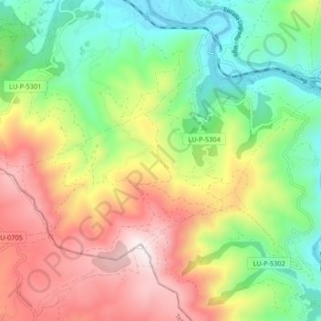
Name: Soutordei topographic map, elevation, terrain.
Location: Soutordei, Ribas de Sil, Quiroga, Lugo, Galicia, 27318, España (42.41196 -7.30200 42.44927 -7.22032)
Average elevation: 650 m
Minimum elevation: 231 m
Maximum elevation: 1,220 m
Thank you for supporting this site ❤️
Make a donation
Make a donation
Gear up for your next adventure:
As an Amazon Associate, this site earns from qualifying purchases at no extra cost to you.