
Khoshal Khil topographic map
Interactive map
Click on the map to display elevation.
About this map
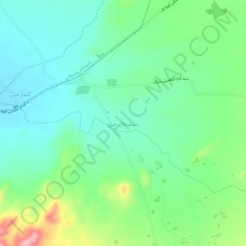
Name: Khoshal Khil topographic map, elevation, terrain.
Location: Khoshal Khil, Said Karam, Paktia Province, Afghanistan (33.66940 69.36703 33.70940 69.40703)
Average elevation: 2,500 m
Minimum elevation: 2,452 m
Maximum elevation: 2,620 m