Geolocate

Kampung Merdeka topographic map

Click on the map to display elevation.

About this map

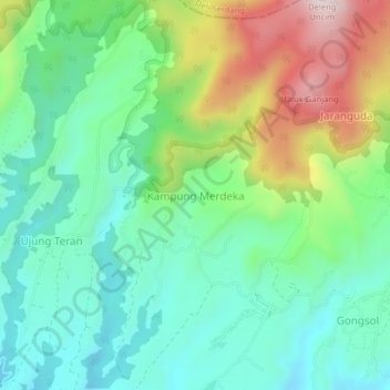
Name: Kampung Merdeka topographic map, elevation, terrain.

Location: Kampung Merdeka, Karo, North Sumatra, Sumatra, 22153, Indonesia (3.18416 98.45391 3.22416 98.49391)

Average elevation: 1,468 m

Minimum elevation: 1,306 m

Maximum elevation: 1,820 m

Other topographic maps

Click on a map to view its topography, its elevation and its terrain.

Berastagi

Indonesia > North Sumatra > Karo

Average elevation: 1,418 m

Gear up for your next adventure:

🧢Outdoor Visor - Breathable visor for sunny hikes
🥾Trail Hiking Shoes - Durable shoes designed for rugged trails
🧢Sun Protection Cap - Breathable cap to protect from sun exposure
🔦LED Headlamp - Hands-free lighting for early morning starts or late finishes
🦯Trekking Poles - Reduced impact on joints for steep topographic climbs

As an Amazon Associate, this site earns from qualifying purchases at no extra cost to you.